The epic tale of the worlds and heroes of the LINK
|
August 30, 2011 3:22
Posted By J Serembe
|
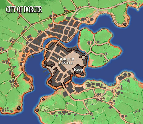
Keldrun (and then Orsan) completed a rebuild of the Dorcer Castle of 799 with a higher version that would not flood so readily in the spring when the River Fortan overswelled it's bank during the thaw. Within the castle walls the street was raised up ten feet. Each building boarded up its front door, and built a new door on it's second floor window. This created vast underwater passageways for the spring runoff. It also created the DOM underground, as each of the original buildings then had a basement with an entrance into the (new) sewer system. Orsan Fane ordered these entrances sealed for the prevention of disease, but he did not enforce his order and it was ignored. The public soon realized that "the underground" had become a lucrative exchange not governed or taxed by the crown. King Orsan's increasing madness in his later years and the massive guilt that he carried for the murder of his brother allowed him to give this present to his people. Lythe Petros also allowed the popular Underground to remain, though he would force all businesses to arrange seals for all underground doors during the spring runoff, when the underground would be evacuated, and the floodgates opened for a spring wash.
|
|
August 26, 2011 3:19
Posted By J Serembe
|
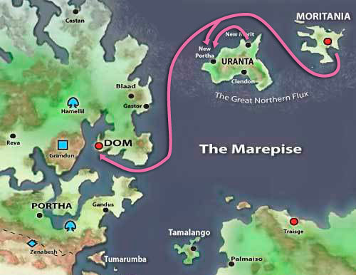
The DOM colony on the continent of Uranta called "New Portha" was given that name by the DOM province that had begun the enterprise. The Island county of Moritania had occupied Uranta's northeastern end for at least twenty years beforehand and laid claim to the entire continent. The nation of Traisge had also established a colony on the southern end of Uranta. All of this despite a primitive native population that probably emigrated from Tixtlan during the Glacial Epoch.
The colony of New Portha proved a costly endeavor, as violence between colonists, natives and the other colonial powers was ongoing. King Lythe Petros II of DOM did not see the advantages of the costly endeavor despite the insistence of Duke Kalen Portha that it would prove invaluable in the years to come. The King repeatedly ignored Portha's requests for aid for the colony. By 1280, Portha was the colony's sole supporter. In the autumn of 1300, Moritania attacked both the colony, and the Kingdom of DOM.
|
|
February 18, 2011 10:14
Posted By J Serembe
|
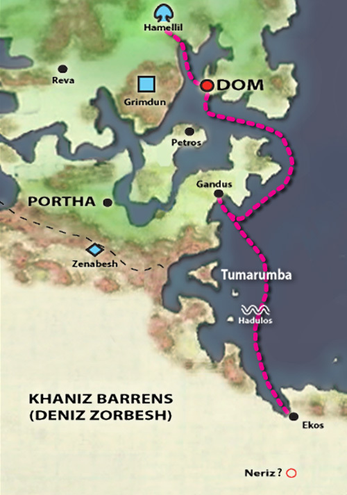
The citry of Neriz was lost in antiquity. It was the seat of power of the Avatar of Khaniza, the "Wolf Goddess" of Water and Fire. (For more information see: 4.4 The Imprisonment of the Gods (c. -8,600)).
This map marks the route of the Bearers of the Elemental Staff.
|
|
November 16, 2010 3:04
Posted By J Serembe
|
This map depicts the colonies of Uranta, including the short-lived colony of New Portha.
|
|
October 27, 2010 1:21
Posted By J Serembe
|
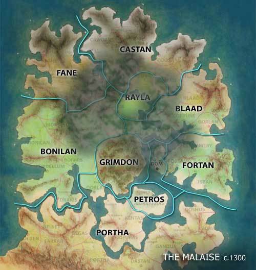
The known geographic extent of the Great Malaise of 1300 as determined by the Council of King Lythe Petros II.
|
|
October 2, 2010 8:16
Posted By J Serembe
|
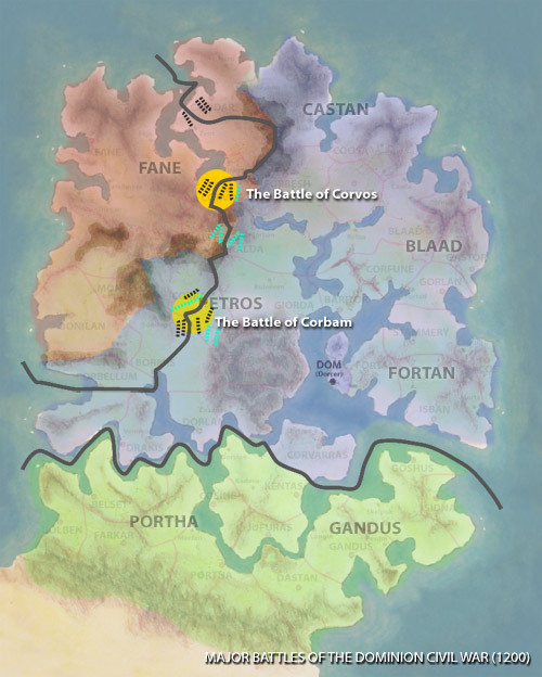
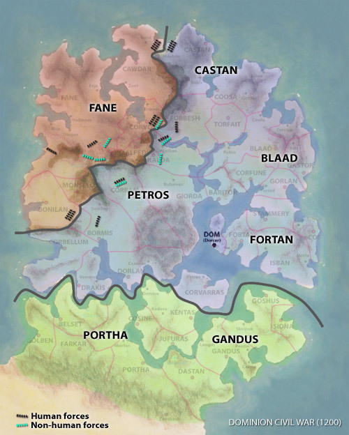
The deciding battle of the DOM Civil War.
|
|
September 12, 2010 8:23
Posted By J Serembe
|
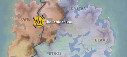
The decisive battle of the south is fought in and around Corbam. And the forces under the command of Forcellus Blaad face down Fane in their own territory. Castan had the northern Fane troops trapped on a peninsula of land, and the Orog and Grimdon opposed each other in the Malpedun Pass.
|
|
September 3, 2010 10:55
Posted By J Serembe
|
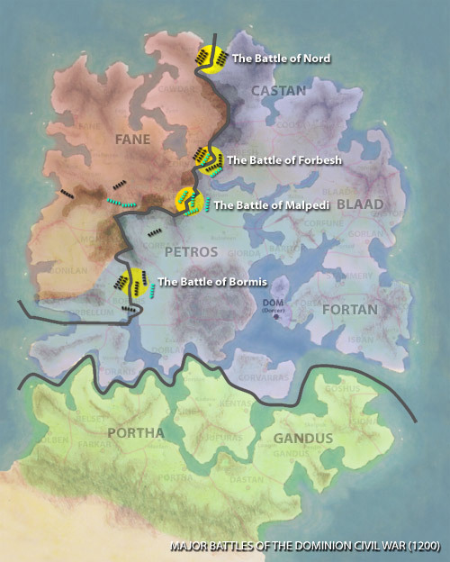
Map depicting the first four battles of the Domish Civil War. In Bormis (commander Garthon Blade, and with King Lythe, His Eminence Tirian and Lord Jared). In Malpedi (Commanders King Ironfist Grimbow of the Grimdon and Kanaille of the Raylan). In Forbesh (Commander Forcellus Blaad), and in Nord (Commander Duke Lars Castan).
|
|
August 28, 2010 4:40
Posted By J Serembe
|
This map depicts the Fane and Crown holdings at the start of the Domish Civil War. Fane had already seized Bonilan and secured the Revan Pass before the crown could react.
|
|
August 27, 2010 9:08
Posted By J Serembe
|
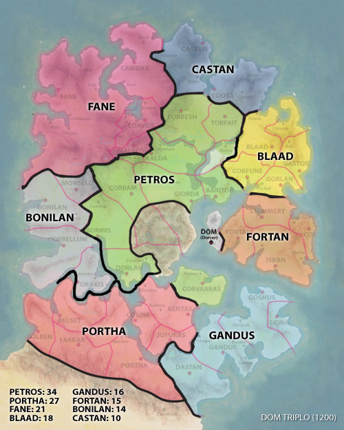
This map depicts the final outcome of the DOM Triplo Contest and the disposition of provinces before the Domish Civil War.
|
|
July 14, 2010 11:46
Posted By J Serembe
|
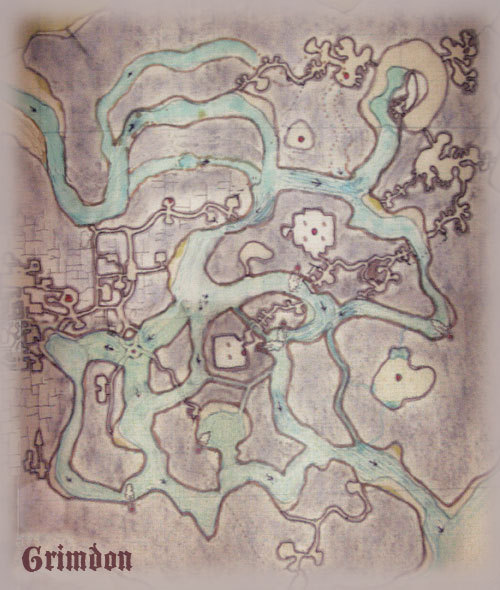
This is the map that was given to Lythe Petros and party as they prepared for their visit to Grimdon in 1199. Nothing depicted is completely accurate or to scale, but it did give them a basic understanding as they headed in by way of the Corbam River (top left) and to find their way to the Dorcer Sea (bottom right).
Click here for a larger version of this map.
|
|
July 2, 2010 10:07
Posted By J Serembe
|
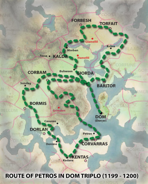
This map depicts the routes that the Petrosians took during the historic march for Kingdom during the DOM TRIPLO contest.
|
|
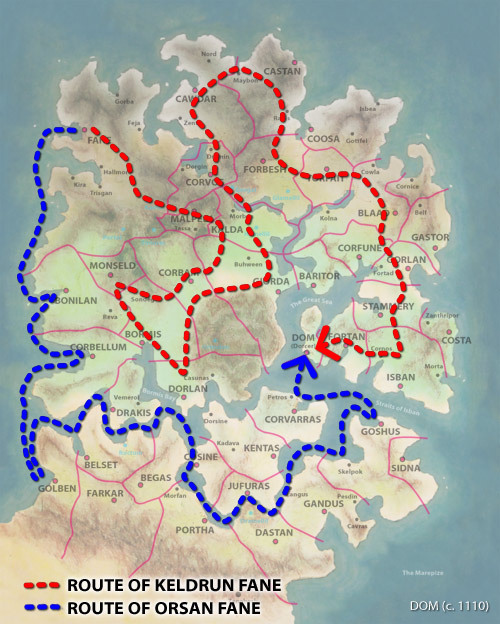
June 19, 2010 1:50
Posted By J Serembe
|
This map depicts the eleven year March for the Dominion Of Man (1,115 - 1,126) that brought Keldrun Fane to the City of Dorcer (subsequently renamed DOM City) to establish a new Dominion cosisting of all of the Kingdoms of DOM (which became provinces). Keldrun became it's first King. He gave Orsan his old job as King of Fane (now Provincial Governor of Fane). Orsan would be next-in-line if Keldrun were to die, or if he did not produce children.
Note: the map title incorrectly reads "1,100". That date marks the beginning of the logistical planning for the march (originating with Keldrun's father Eclan Fane I) and is often used in histories as the beginning date. The actual march began in the spring of 1,115 and ended eleven years later.
|
|
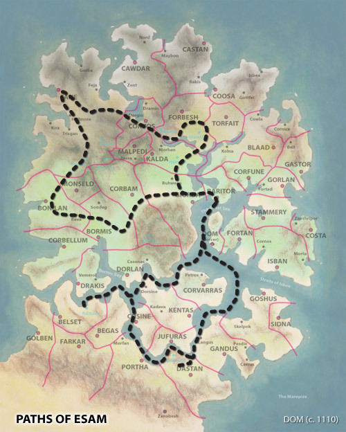
June 18, 2010 7:18
Posted By J Serembe
|
Illustrates the route that Esam took on his pilgrimage throughout DOM starting and ending in Baritor. It can also be noted that DOM consisted of only 40 Kingdoms at this point. Cawdar was an "ally" of Fane (actually more of a puppet government of Fane than an idependent entity).
|
|
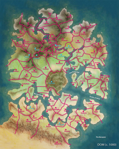
June 16, 2010 9:51
Posted By J Serembe
|
The Domish Kingdoms c. 1000. Each Kingdom named after the family in control, the city-state bearing the same name. Borders stabilized for the most part at this time. The regions marked by a blue city-state were non-human dominions. By 1100, even these regions would be claimed (though not entirely subjugated) by humans.
Click for larger map
|
|
|
|